We discuss the key benefits of utilising drones for surveying. Discover the benefits of aerial data collection for detailed mapping, monitoring, and analysis across a wide range of industries, including construction, agriculture, and property. Drone surveying is now a crucial part of many modern surveying services in the UK because it can produce accurate data quickly, even in hard to reach areas.
Accuracy
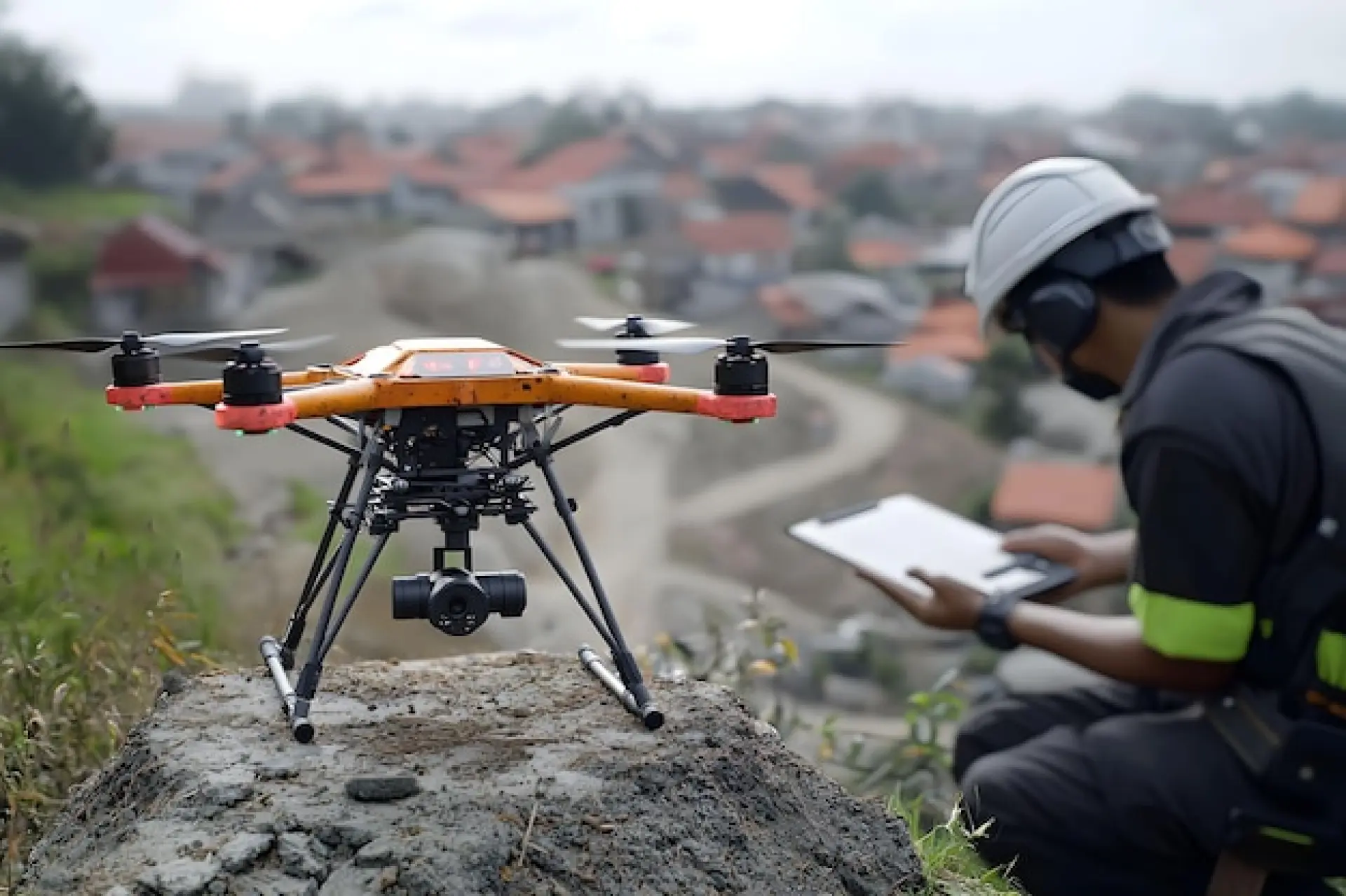
One of the most important benefits of drone surveying is accuracy. Using drones fitted with high resolution cameras and advanced sensors, surveyors can capture high quality information from above and from different angles. This supports accurate data collection and helps produce 3d models, high resolution images, and detailed 3d models that show the site in clear detail. These results help reduce guesswork and improve precision, especially when the ground is uneven or the terrain is complex.
Traditional surveying methods can struggle when the area is large, steep, dangerous, or impossible to reach on foot. In those situations, using a drone can be the safest and most efficient way to collect data. A drone survey can also create point clouds, which are dense sets of measured points used for mapping and analysis. This level of detail is paramount when small changes can affect planning, safety, and costs.
Time Effective
Drone surveys can cover large areas in a fraction of the time compared with traditional methods. What once took days of working on the ground can often be done in hours, because drones can fly at a set height and follow a planned route. This makes the surveying process far less time consuming and helps projects move forward without long delays.
Another benefit is that drone technology can support real time updates. During data collection, teams can often review early results quickly, spot gaps, and repeat a flight if needed. This faster flow of information supports decision making, because stakeholders and clients can see what is happening on site and respond quickly if priorities change.

Cost Effective
Drone surveying is often cost effective because it reduces the number of people required on the ground and cuts down on travel and repeat visits. With traditional surveying methods, a team may need several site trips, especially if access is limited or the area is large. Using drones can reduce these visits and still provide accurate data, which helps control costs across the full project.
It can also reduce the hidden costs linked to errors. High resolution cameras and precise sensors can improve accuracy and lower the risk of missed measurements. When surveyors can trust the data, there is less need for rework, fewer delays, and fewer expensive changes later in the job.
Health and Safety
Health and safety is a major reason many surveyors now use drones. Some sites include unstable ground, steep slopes, damaged structures, or other dangerous conditions.
Sending people into these areas can be risky, and in some cases it is not safe at all. Drone surveys reduce that risk because data collection can be done from a safe distance, with fewer people walking across hazardous terrain.
This is also important on active construction sites, where moving vehicles, working at height, and changing ground conditions can create extra risk. Using drones helps ensure safer working practices while still delivering the essential information needed for planning and progress checks.

Easy Access
Drones provide access to hard to reach areas where ground based work can be difficult, slow, or even impossible. This includes tall structures, tight spaces, marshy ground, cliffs, and large sites with limited entry points. Instead of taking a risky step onto unstable ground, a drone can fly over it, record high resolution images, and collect the data needed for surveying and mapping.
Better accessibility also helps when deadlines are tight. If surveyors can reach more areas quickly, they can keep projects on track and reduce delays caused by slow site access or poor conditions underfoot.
Better Data Collection and Clear Deliverables
Modern drone technology does more than take photos. Many drone surveying workflows combine photogrammetry with sensors that support detection and ranging. Some projects also use lidar, which stands for light detection and ranging, to measure distances by sending out pulses of lidar light. This can be especially useful in areas with complex terrain, vegetation, or structures where extra detail is needed.
These tools can produce accurate data in forms that are easy to share, such as 3d models, point clouds, and high resolution images. This makes it easier for a project team to compare results over time, check measurements, and spot issues early. It also supports better analysis, because the data can be reviewed again later without needing to return to site.

Progress Monitoring and Managing Changes
Drone surveys are very useful for monitoring progress and tracking changes across a site. By repeating flights at set times, surveyors can build a clear picture of how work is moving forward. This is helpful in construction projects where the site can change quickly, sometimes within days. Regular drone surveying creates updated records that help ensure work matches plans and that problems are found early.
This type of monitoring also improves communication. Stakeholders can view clear visuals and measurements, which helps everyone understand what is happening and what needs attention. When clients can see the latest results, it can reduce confusion and support faster decisions.
Stronger Planning and Lower Risk
Good planning depends on accurate information. Drone surveying supports planning by giving a clearer view of the site, including levels, features, and access routes. With accurate data, teams can plan work in a safer and more efficient way, and reduce the risk of surprises later.
Risk is also lowered because drones can collect information without putting people in dangerous areas. This matters when surveying near unstable ground, busy roads, water, or damaged structures. Using drones helps ensure that safety remains paramount while still delivering the surveying detail required.
Progress Monitoring and Managing Changes
Drone surveys are very useful for monitoring progress and tracking changes across a site. By repeating flights at set times, surveyors can build a clear picture of how work is moving forward. This is helpful in construction projects where the site can change quickly, sometimes within days. Regular drone surveying creates updated records that help ensure work matches plans and that problems are found early.
This type of monitoring also improves communication. Stakeholders can view clear visuals and measurements, which helps everyone understand what is happening and what needs attention. When clients can see the latest results, it can reduce confusion and support faster decisions.
Useful Across Many Industries
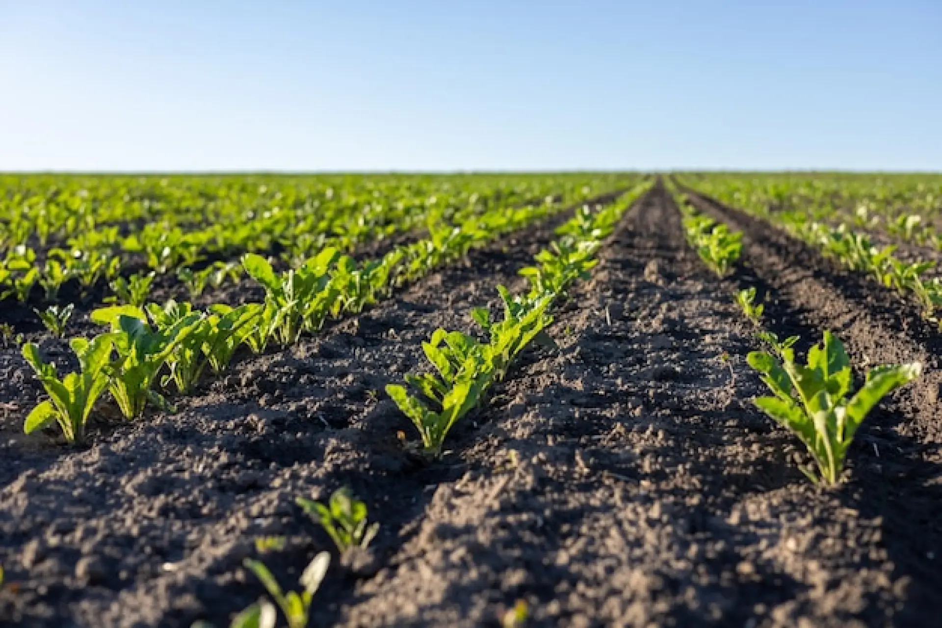
The benefits of drone are not limited to one sector. In construction, drones help with site mapping, volume checks, and progress monitoring. In agriculture, they can support crop checks and field planning by showing patterns in large areas that are hard to see from the ground. For property work, drone surveys can help record roofs, boundaries, and difficult angles without needing ladders or long access equipment.
Drones are also used for environmental monitoring, where surveyors need to cover wide range areas with minimal disruption. In some cases, drones support search tasks by helping teams locate people more quickly, especially when the area is large or the ground is difficult to cross.
More Efficient Team Work and Better Service
Using drones can improve the way a team works together. Data can be shared quickly, reviewed by different people, and used to create reports that are easier to understand. This can improve surveying services because the process becomes more consistent, more efficient, and easier to repeat when needed.
Over the last few years, the ability to collect accurate data quickly has become a key advantage for many industries. Whether the need is mapping, monitoring, planning, or analysis, drone surveying gives surveyors a practical way to deliver high quality results while reducing time, costs, and risk.
At Dog House Drones, we provide drone survey and inspection services across Milton Keynes, Buckinghamshire, and the surrounding counties. We offer a range of services with a customer focused approach and an ethos of preventative maintenance that will deliver cost-savings, minimised disruption, and a vastly reduced carbon footprint to our customers.
We’re fully qualified, efficient, trustworthy, and have the expertise to provide the exact services that our customer’s require.